Category Archives: ruins

St. Clair Ruins

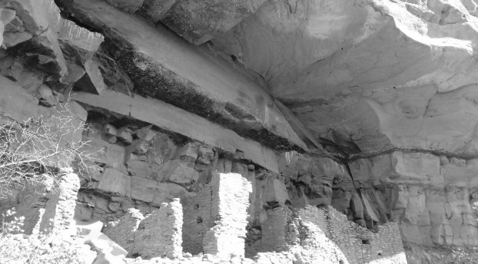
“Below the summit, most of the buildings have crumbled to mere rock piles, but many walls remain intact enough to show outlines of where rooms used to exist. Emil and Bruce Valehrach, archaeologists who excavated the ruin in the late 1960s, found that the summit and surrounding slopes of St. Clair Mountain had ninety-two rooms when they were occupied sometime between A.D. 1100 and 1300. Among many other things, the 1960s excavation also turned up bracelets made from seashells that had been buried along with many of the pueblo’s inhabitants. The arm of one skeleton bore thirteen bracelets, all made from large round shells with their centers bored out almost to the edge so that only a thin rim was left. These bracelets inspired one of the excavators to name the ruin Brazaletes Pueblo, a Spanish reference to the jewelry, and today many people call the village atop St. Clair Mountain by that name.”

– Hiking Ruins Seldom Seen, Dave Wilson

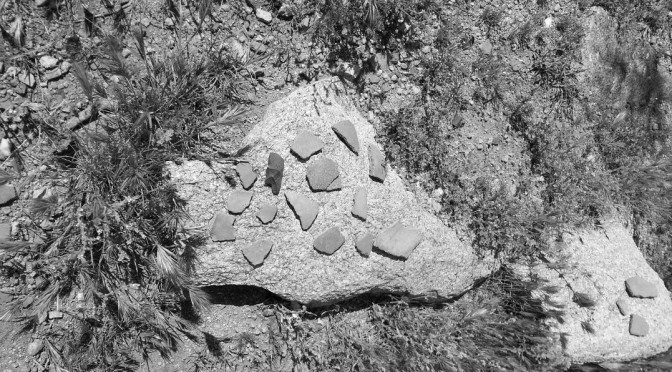
This site had one of the most abundant collections of pottery sherds I’ve seen at a ruin. In addition, we found a very clear grinding stone, which is pictured below.

Black Mountain Ruins

These ruins are near the town of Gisela, AZ, and are suspected to have been built by the Salado in the 13th century.

After a short but steep hike, there are many well-preserved walls at the top of Black Mountain. One can easily discern the various rooms and the ‘avenues’ between them.

Interestingly, there appeared to be wild watermelons growing in the corner of a few rooms.

This ruin was difficult to photograph due to the tall grass and side of the summit. I’d like to return for another attempt.

Honanki Heritage Site

After more than a year, I was able to return to Sedona see Honanki, the sister-site of Palatki. Like Palatki, there is a stunning collection of pictographs and cliff dwellings. The dwellings at Honanki are less intact than at Honanki, but it is no less worth a visit. I suggest planning for enough time to see both Palatki and Honanki if you’re in the area. However, the road gets rougher after Palatki, and accessing Honanki may require high clearance depending on the time of year.

The Sinagua occupation of Honanki was probably between 1130 and 1280 CE, based on a tree-ring date of 1271 (from a wooden beam in the ruin) and other archaeological evidence.

-https://en.wikipedia.org/wiki/Honanki

Juans Canyon Ruins

These ruins are located in the Tonto National Forest, a few miles north of Sears-Kay and other sites. Access is somewhat difficult, and required driving on rough forest roads and hiking off-trail. The effort was rewarded however, by finding a well-preserved structure and other archeological items.

Highlights of this ruin were:

  • Abundant pottery shards and cutting tools
  • Overgrown but well-preserved and clearly-defined rooms
  • The remains of a short wall(?) on the north-east side of the ruin. It doesn’t appear to be defensive in nature, due to its height and position only on one side of the ruin.
  • A set of rocks positioned in a rectangle, about half-way between the ruin and the short wall. This seemed intentionally placed.

This ruin was intriguing, and I would like to go back with the intention of creating a detailed map of the site.